Printed
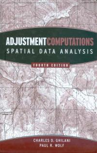
Adjustment Computations Spatial Data Analysis
This 4th edition covers basic terms and fundamentals of errors and methods of analyzing them and progresses to specific adjustment computations and spatial information analysis. Each chapter includes practical examples, illustrations, and sample practice problems. Current and comprehensive, the book features:
. Easy to understand language and an emphasis on
real world applications
. Extensive coverage of the treatment of GPS
acquired data
. New chapters on analyzing data in here
dimensions, confidence intervals, statistical
testing, and more
. Extensively updated STATS, ADJUST, and MATRIX
software packages
. A new companion CD & web site with a 150 page
solutions manual, software, MathCAD worksheets,
and view graphs
. The latest information on advanced topics such
as blunder detection and the method of general
least Squares
Adjustment Computations 4th edition is an invaluable reference and self study resource for working surveyors, photogrammetrists, and professionals who use GPS and GIS for data collection and analysis, including oceanographers, urban planners, foresters, geographers, and transportation planners. It’s also an indispensable resource for students preparing for licensing exams and the ideal textbook for courses in surveying, civil engineering, forestry, cartography, and geology.
Ketersediaan
Informasi Detail
- Judul Seri
-
-
- No. Panggil
-
526.9 GHI a
- Penerbit
- New Jersey : John Wiley & Sons, Inc., 2006
- Deskripsi Fisik
-
xvii, 611 hal. : ilus. ; 24 cm + 1 CD
- Bahasa
-
English
- ISBN/ISSN
-
978-0471697282
- Klasifikasi
-
526.9
- Tipe Isi
-
-
- Tipe Media
-
-
- Tipe Pembawa
-
-
- Edisi
-
4
- Subjek
- Info Detail Spesifik
-
-
- Pernyataan Tanggungjawab
-
-
Versi lain/terkait
Tidak tersedia versi lain
Lampiran Berkas
Komentar
Anda harus masuk sebelum memberikan komentar

 Karya Umum
  Filsafat
  Agama
Agama  Ilmu-ilmu Sosial
  Bahasa
  Ilmu-ilmu Murni
  Ilmu-ilmu Terapan
  Kesenian, Hiburan, dan Olahraga
  Kesusastraan
  Geografi dan Sejarah